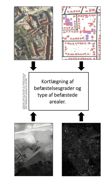
A detailed geographical mapping of different surface types and their degrees of consolidation in very high resolution for use as input to drainage models, runoff analyzes and flood modeling in urban areas. The mapping is based on publicly available data, which is updated regularly, including GeoDanmark data and aerial images. The mapping is carried out using Geographical Information Systems (primarily QGIS).
The main deliverables from the mapping include
A raster dataset containing information about surface type (15-20 different classes) with a pixel size of 12.5cm A vector data set (shp. file) with catchments containing information about the area of each surface type as well as a total degree of fortification for each catchment. Documentation of the mapping, quality assurance and possible comparison with previous analysis.
It is recommended that the full mapping be updated every approx. 3 years, and that each year a small analysis of the extent of changes in the previous year is carried out.
Contact Per Skougaard Kaspersen for more information on surface mapping.